Reduce Excavation Risk
Better information about potential buried services and other subsurface features helps project teams assess risks before intrusive work begins.

GPR Surveys
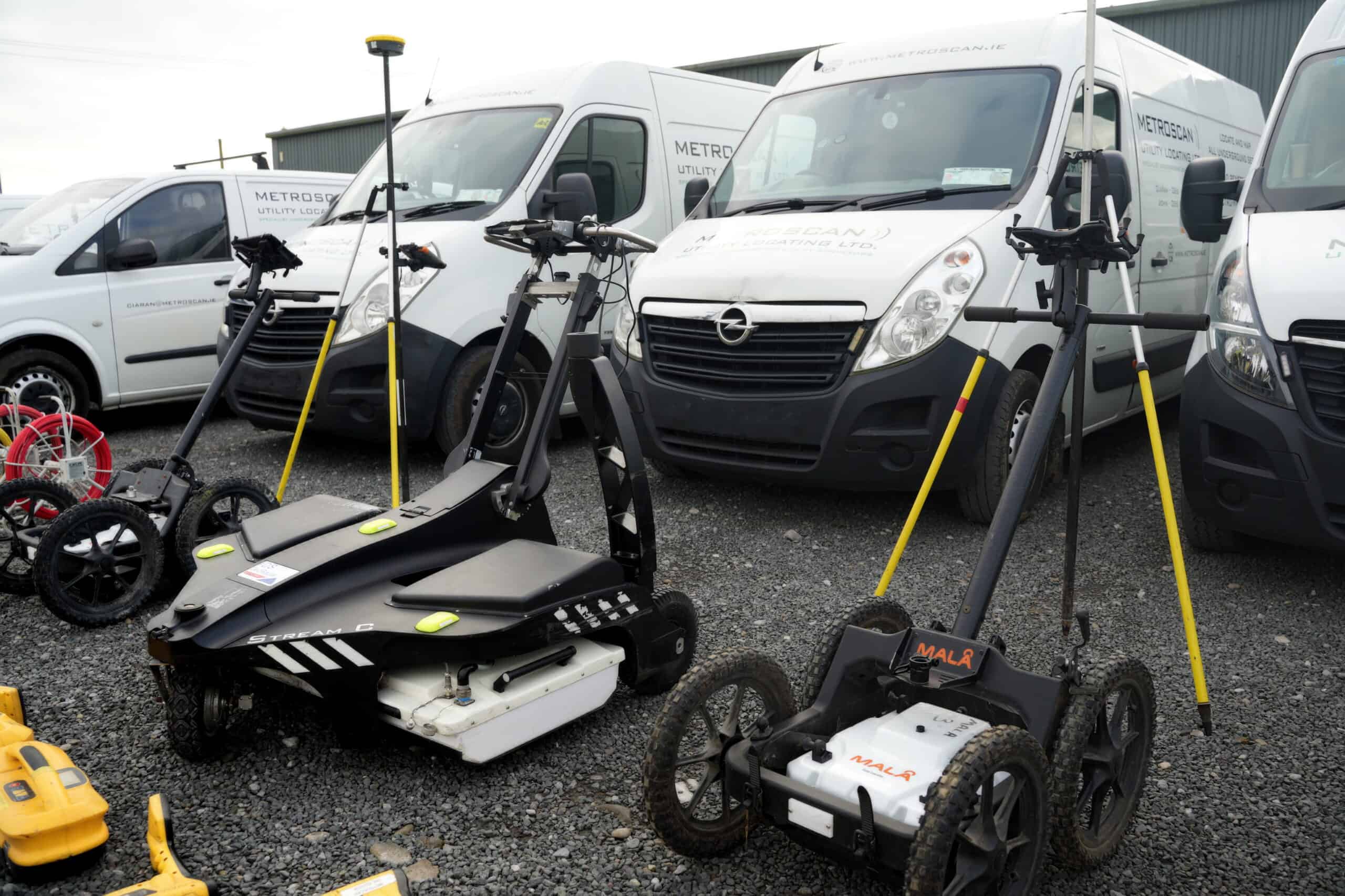
Ground Penetrating Radar (GPR) surveys provide valuable subsurface information before excavation, construction, design or investigation work begins. At Metroscan, we deliver professional GPR surveys across Dublin, County Kildare and nationwide Ireland, helping engineers, contractors, developers and local authorities identify potential underground features and make better-informed project decisions.
Why Choose MEtroscan
Call +353 86 193 5847, +353469701915 or email ci****@*******an.ie to discuss your project.
Understanding GPR
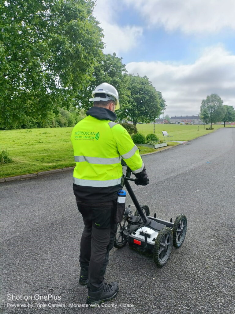
Ground Penetrating Radar (GPR) is a non-invasive surveying technique used to investigate what lies beneath a surface. It works by sending electromagnetic energy into the ground and recording the reflections created by underground features and changes in material.
A GPR survey can help experienced technicians identify and interpret subsurface features that may affect a construction, engineering or investigation project.
GPR can be used across suitable surfaces such as:
The effectiveness of a GPR survey can vary depending on the ground conditions. For example:
For projects focused on buried utilities, GPR can also form part of a wider underground utility locating survey, alongside complementary detection and mapping techniques.
Depending on site conditions, survey requirements and the characteristics of the target, GPR can help identify a wide range of underground and structural features.
These may include:
No subsurface surveying method can guarantee that every buried feature will be detected. GPR results are influenced by factors including ground composition, moisture, depth, target material and site conditions. Metroscan therefore uses GPR as a professional investigation and risk-reduction tool rather than making claims of 100% underground detection.
How We Help
If you’re looking for a GPR survey in Ireland, Metroscan supports professional teams throughout the planning, investigation and construction lifecycle.
Our GPR surveys are particularly relevant for:
GPR surveys can also be coordinated with topographical surveys and construction surveys where projects require a broader understanding of site conditions.
Better information about potential buried services and other subsurface features helps project teams assess risks before intrusive work begins.
GPR is a non-invasive surveying technique, allowing subsurface investigation without immediately digging trial holes or otherwise disturbing the ground.
Understanding potential underground constraints earlier can support more informed decisions during design, planning and construction.
GPR can complement electromagnetic utility locating by investigating features that may not be identifiable through conductive tracing methods alone.
Survey findings provide engineers, contractors and other stakeholders with additional information to assess site conditions and determine appropriate next steps.
GPR information can be processed and combined with other survey datasets to produce clearer project deliverables. Learn more about our GPR post processing and GPR utility survey data deliverables.
We start by reviewing the project requirements, survey area, site conditions and available drawings or utility information. Understanding what the project team needs to investigate helps us determine an appropriate survey approach.
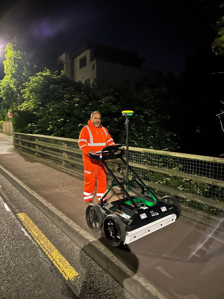
GPR equipment is moved systematically across the required survey area, transmitting electromagnetic energy beneath the surface and recording reflected signals.
The equipment and survey approach are adapted to the site and investigation requirements.
Collecting GPR data is only one part of a successful survey. Experienced interpretation is essential when assessing recorded responses and identifying features that may be relevant to the project.
Our technical experience helps turn complex survey information into practical findings for engineers and project teams.
Following the site survey, data can be processed into clear outputs appropriate to the project requirements.
For projects requiring more detailed analysis of collected datasets, our dedicated GPR post-processing service can transform raw information into clearer, usable project data.
Ground Penetrating Radar is not limited to underground utility locating.
GPR can also be used to investigate suitable concrete and structural elements, helping identify features such as reinforcement and other detectable anomalies before drilling, cutting, refurbishment or further investigation.
Where a project requires broader information about an existing structure, GPR can complement our building survey services.
Nationwide Project Delivery
Metroscan provides Ground Penetrating Radar surveys throughout Ireland, with regular project work across:
Based in County Kildare, our team is accustomed to travelling for specialist surveying work and supporting both short-term surveys and larger projects requiring an extended site presence.
A Ground Penetrating Radar survey uses electromagnetic energy to investigate subsurface conditions without excavation. Reflections within the recorded data can help trained technicians identify potential utilities, structural features, voids and other detectable anomalies.
Yes. GPR can help identify underground utility infrastructure and is particularly valuable as part of a wider utility locating survey. Results depend on the characteristics of the service, its depth and surrounding ground conditions.
Depending on site conditions, GPR may help identify infrastructure associated with water, gas, drainage, electricity and telecommunications, as well as ducts and other buried features. Detection capability varies from site to site.
No. No responsible subsurface survey should guarantee 100% detection. GPR performance can be affected by ground conditions, moisture, depth, target characteristics and other site-specific factors. The survey is designed to improve available information and reduce project risk.
GPR can be used across a variety of suitable surfaces, including tarmac, concrete and soil. The survey approach will depend on site conditions and the purpose of the investigation.
Yes. Ground conditions can significantly affect GPR performance. Dry, sandy soils can offer favourable conditions, while dense, wet clay may reduce penetration and make subsurface responses more difficult to interpret.
GPR can be used to investigate reinforcement and other detectable features within suitable concrete structures. The achievable results depend on the structure, survey access and project requirements.
Not exactly. GPR is a surveying technology that can be used as part of an underground utility survey. A wider utility locating project may incorporate GPR alongside other detection methods, available records and site observations to provide more comprehensive information.
Survey duration depends on the size and complexity of the site, access, ground conditions and the required level of detail. Metroscan reviews these factors before confirming the survey programme.
Where available, provide the site location, survey boundaries, project scope, existing utility drawings or site plans, the purpose of the investigation and any relevant programme requirements. This helps our team determine the most appropriate survey approach.
Collected information can be reviewed, interpreted and processed into project-specific outputs. More complex datasets may benefit from dedicated GPR post processing and integration with other survey information.
Start Here
Whether you are preparing for excavation, investigating underground utilities, assessing a construction site or need additional information about what lies beneath an existing surface, Metroscan can provide professional GPR surveying tailored to your project.
We deliver Ground Penetrating Radar surveys across Dublin, County Kildare, Cork and nationwide Ireland, combining specialist equipment with experienced interpretation and practical survey support.
Tell us what you need to investigate and we’ll help determine the appropriate approach for your site.
